From a Regional Information Medium
to a Location-Based Interaction Platform

The earliest known map, crafted around 1300 BC, was designed for gold mining explorations. While it omitted continents like America and Oceania, the creation of the world’s first map can be traced back to approximately 699 BC. Maps are a testament to humanity's intellectual journey, continually evolving over centuries, driven by the demands of exploration, warfare, migration, commerce, and resource discovery. The profound sense of history and effort that emanates from unfolding a map speaks to this rich legacy.
The last 30 years have seen digital maps evolve more rapidly than in the previous three thousand years, a transformation fueled by leaps in computing power, Internet proliferation, and satellite technology. This shift, where digital tools supplanted pens and drafting knives, marked a revolutionary chapter in cartography.
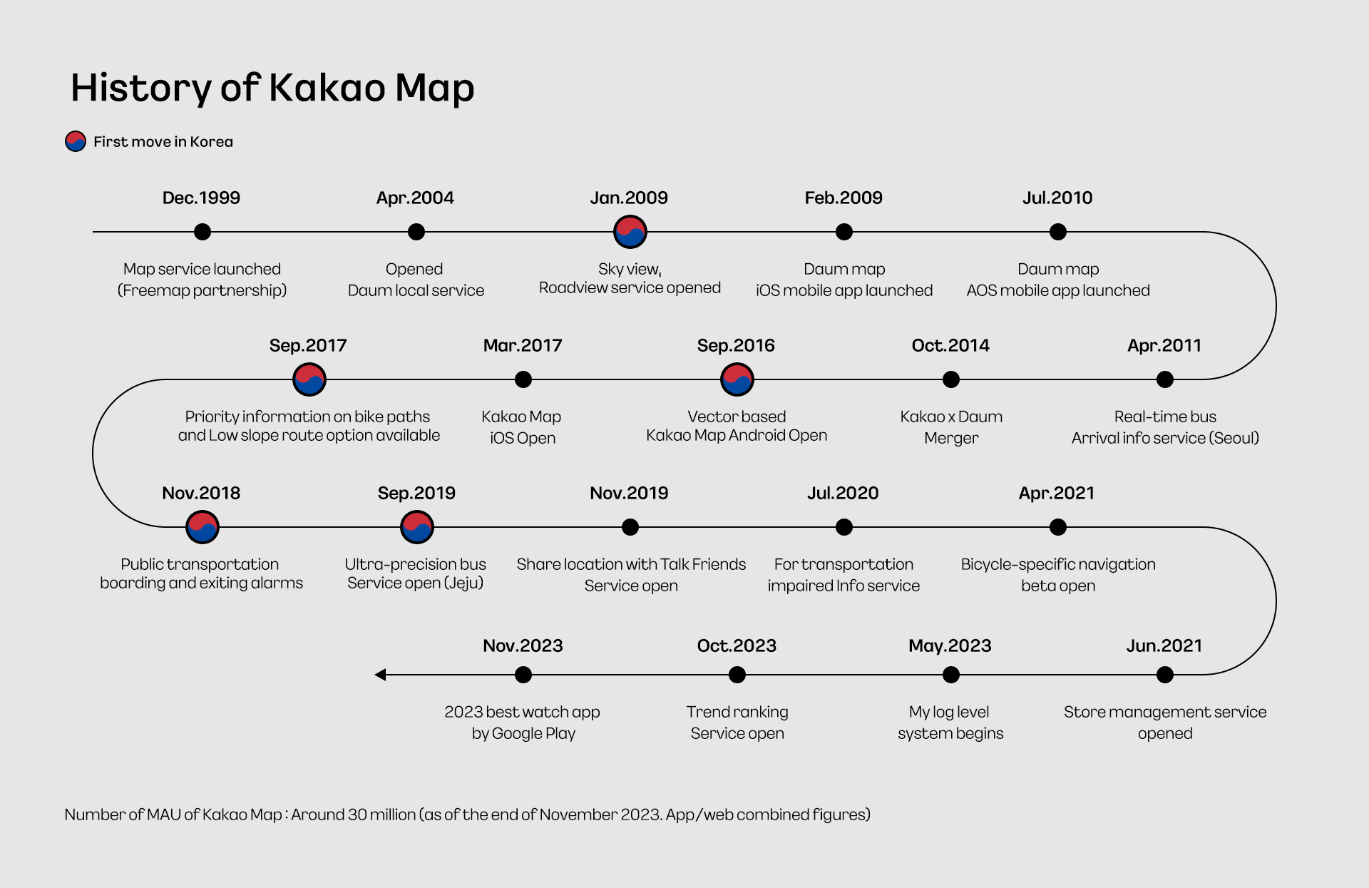
The core principle of map-making has always been to 'portray what exist where through images.' With the dramatic reduction in the time and effort required for this task, humanity has been empowered to infuse maps with an even broader spectrum of ideas. In South Korea, this digital mapping renaissance began to gain significant momentum in the late 1990s. Daum, a pioneering tech company, debuted its map service in December 1999, taking the first step in map services.
#Did Internet Maps Originate with an O2O (Online to Offline) Focus?
In a retrospective news analysis, the early intentions behind South Korea's pioneering Internet map services, initiated by private companies, seemed focused on creating a 'comprehensive database of store information'. Back in September 1997, Company B declared its bold goal through its nationwide sales team: to gather detailed maps of stores at the city, county, and district levels, with an aim to evolve this into a commercial advertising platform within three years. Subsequently, in December, telecommunications company K revealed its new service in Seoul, enabling users to locate businesses and get directions by simply inputting the business name online. This period marked the inception of the 'O2O (online to offline)' concept, which would later become a cornerstone business model in the era of smartphones post-2010.
Following 1998, numerous entities, including the Ministry of Construction and Transportation (now the Ministry of Land, Infrastructure, and Transport), dedicated themselves to the development of GIS (Geographic Information Systems) and the enhancement of map search features. A significant shift occurred around 1999, with digital maps becoming accessible in web browsers without the need for additional software. Features like zooming in and out, moving to different locations, and adjusting the map display size became more flexible, and it was possible to email searched locations, all underpinned by the synergistic progression in computing power, communication infrastructure, and software technology.
In December 1999, the web portal Daum also stepped into the map service arena. Amidst the competitive landscape of approximately ten providers, including major PC communications and portals, little did anyone anticipate that Daum's map service (now known as KakaoMap) would emerge as the sole enduring platform in this field.
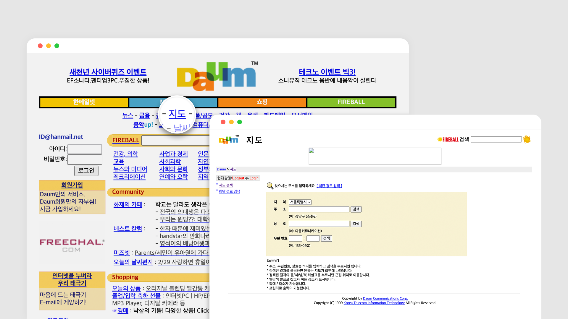
A view of Daum featuring its 'Map' service at the top of the main page (Source: http://web.archive.org/. Archive from February 2000)
#Pioneering Strides: Crafting a Legacy of Trust
The inaugural map service introduced by Daum was essentially an integration of 'Freemap' information, presented as a dedicated page on the portal. This design was more focused on displaying a range of lifestyle and commercial details on the map rather than solely on its geographic information capabilities. A pivotal advancement in aligning the service with common map usage needs emerged in September 2002, with Daum transitioning its map provider to 'Kongnamul'. This shift not only heralded technical improvements, such as 3D mapping features and precise route distance calculations but also enhanced user convenience with tailored search results based on various business categories.
In April 2004, Kakao (formerly Daum Communications) brought Twinkle Little Star, the company behind Kongnamul Maps, into its corporate family. This acquisition signified a crucial step towards integrating advanced technology and elevating the overall service quality. Following this, local information branched out, forming alliances with ten portals specializing in lifestyle information, and was rebranded as 'CityN', distinct from the map service itself.

Daum Maps underwent a significant update in October 2006, leveraging its internally developed technology. The key feature of this update was the application of AJAX (Asynchronous JavaScript and XML), a technology acclaimed as the next-generation web standard at the time. This allowed users to conduct map searches quickly and easily without being constrained by the web browser environment. The update introduced a 'Search within Map' feature, enabling users to move to a region of interest with a mouse movement and automatically receive search results within the moved coordinates. Additionally, a map scrap (sharing) feature was added, allowing users to easily save their desired map views to blogs, cafes, and other online communities.
Among long time Internet users, there's a strong trust associated with the phrase "When it comes to maps, it's Kakao (formerly Daum)." This perception has seamlessly transitioned to KakaoMap today. Moreover, this is often the reason KakaoMap is the first map application installed on the smartphones of their families and friends. A closer look at this virtuous cycle reveals a history of being 'the first in the country' in various aspects.
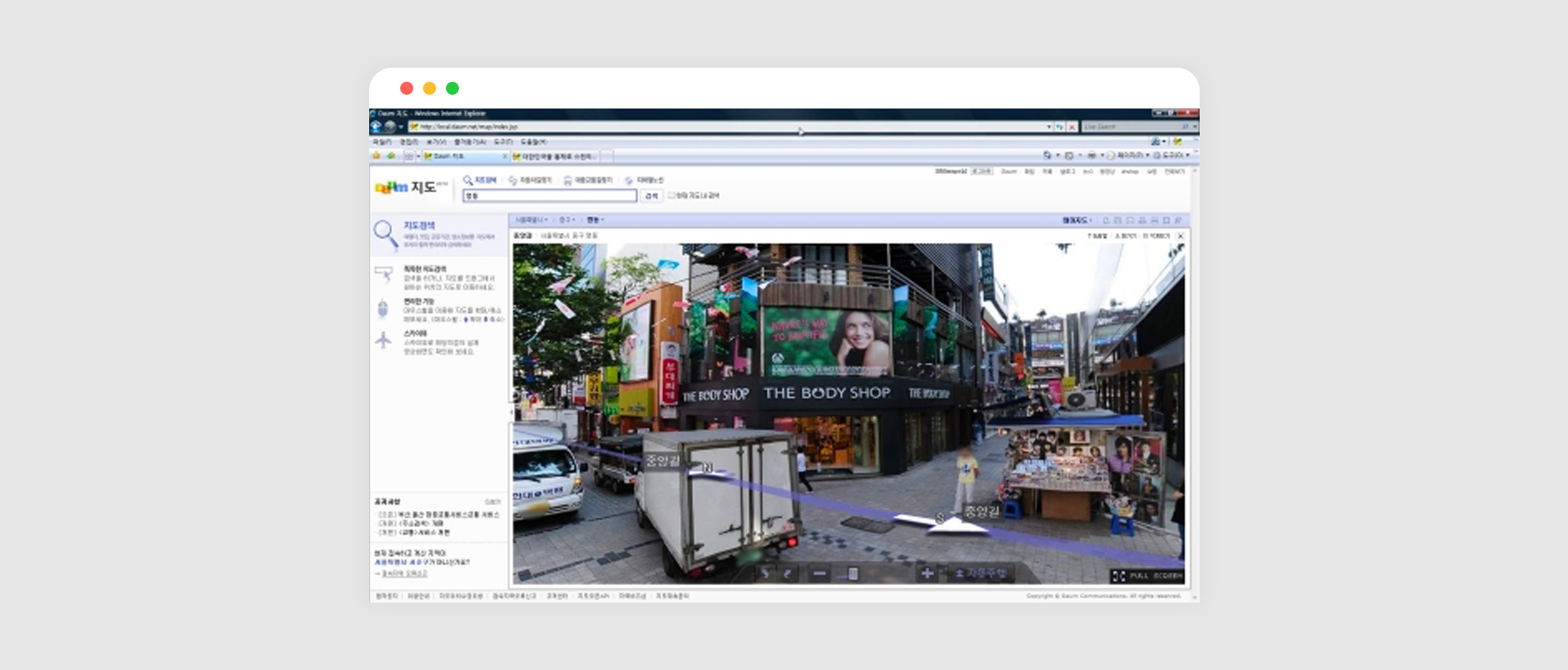
In May 2008, the beta service of 'Road View' commenced, further strengthening this circle of trust. Just as people commonly refer to adhesive bandages as 'Band-Aids', referring to Internet maps showing streets and roads as 'Road View' has become natural. After a seven month beta period, Road View officially launched, accompanied by the introduction of 'Sky View', providing the country’s first high-resolution aerial photographs with 50cm precision. Consistent updates have expanded Road View to cover almost the entirety of South Korea, excluding some islands and mountains, and this has also spurred the creation of similar services by other companies.
In late June 2007, with the release of the first generation iPhone in the United States, Daum's map team sensed the upcoming tide of mobile Internet and swiftly initiated preparations. This foresight led to the launch of their mobile app on the iOS App Store in February 2009, a full nine months ahead of the introduction of the iPhone 3GS in South Korea. Kris, the head of the Map Development Part, who had been dedicated to Internet map development for over two decades, cited this period as the most challenging.

"In those days, when everyone was unfamiliar with mobile OS, we had to craft an entirely new experience tailored to iOS, Windows Mobile, and Android. Debates continued until the mid 2010s about whether smartphones would truly become prevalent or remain mere adjuncts to PCs. Looking back, the challenges we faced in anticipating the mobile era proved to be invaluable nourishment for our growth." This preparation paved the way for the addition of real time bus arrival information services, pedestrian navigation, and other features in the smartphone-dominated landscape of the 2010s.
Just as the initial map services in the late 1990s envisioned a blueprint similar to the O2O business model, the 2010s saw attempts akin to today's metaverse business models.
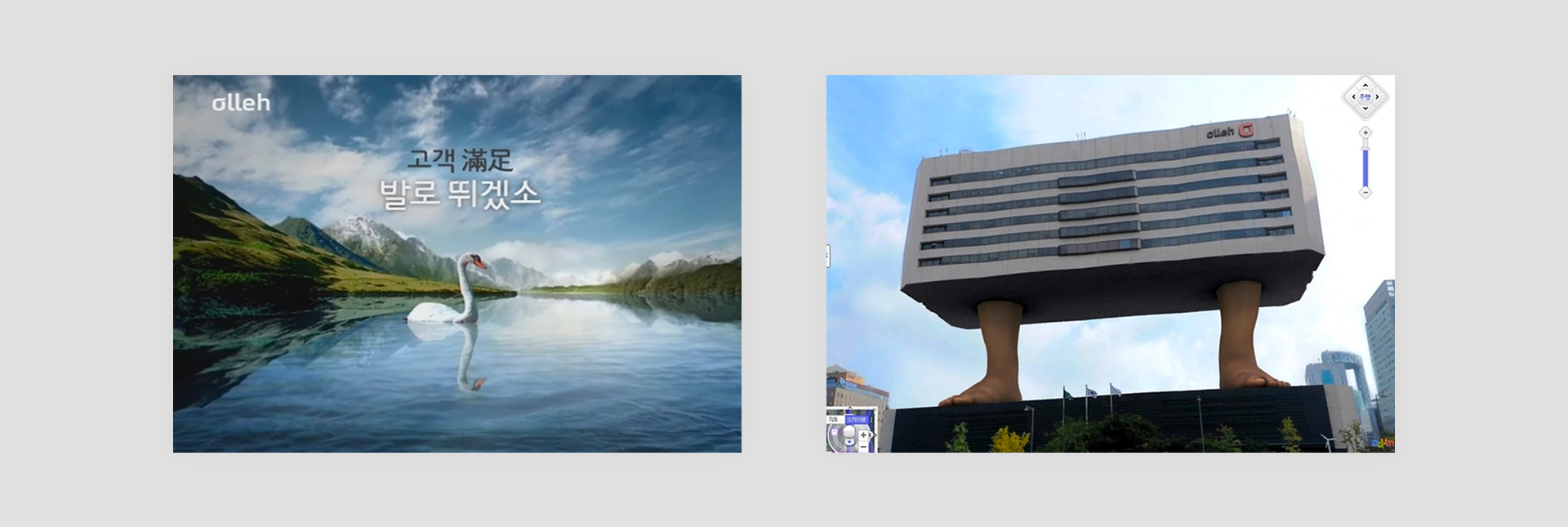
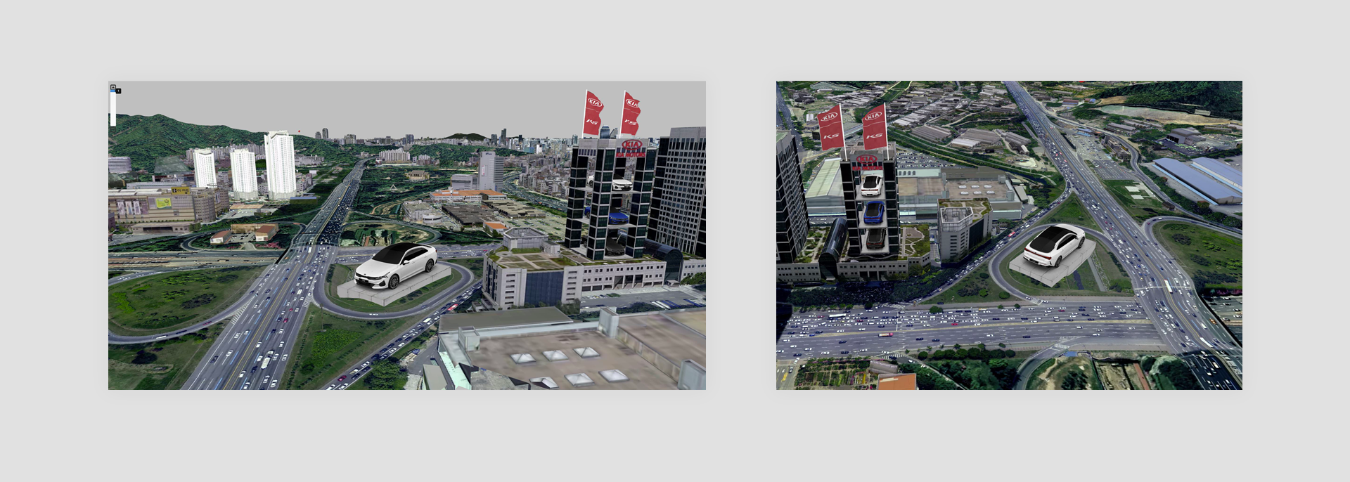
The emergence of online maps as a medium demonstrated the potential to expand the horizon of user experiences into innovative business models. While the augmented reality advertisements of the time were groundbreaking, their symbolic impact outweighed their profitability. Until smartphones, these compact computers, became a ubiquitous tool in the hands of the public, revenue models for map services were limited. Developing and maintaining a robust map service necessitated long-term investment and patience.
Chang, head of the Map Strategy Support Part, sheds light on the intricacies of map services: "Creating a map service isn't as straightforward as merely utilizing publicly available data. It demands a sustained investment in both human and physical resources to enhance its quality. Conversely, the implementation of a defined billing framework for map APIs is a development that has only taken shape quite recently."

Following the merger of Kakao and Daum Communications, the map service was rebranded as 'KakaoMap', leading to a flurry of innovative attempts in the mobile domain.
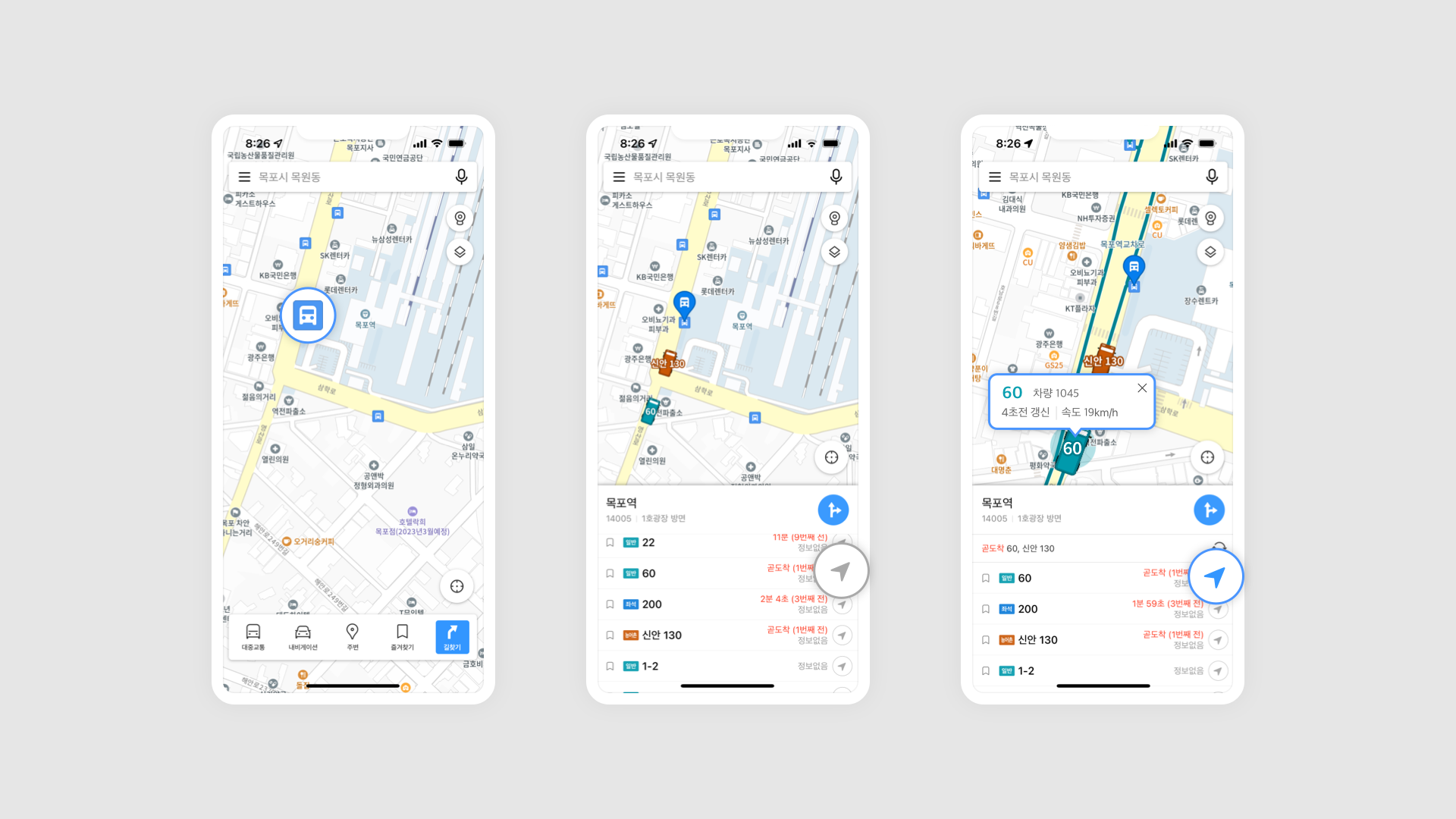
KakaoMap was the first among domestic map services to adopt vector mapping. Vector maps, as opposed to bitmap maps, do not lose image quality when zoomed in and consume less data. With this transition, KakaoMap introduced features like free rotation, 3D views, and 3D Sky View. Additionally, users could easily adjust the map's orientation and elevation with a two finger gesture, simplifying the process of identifying buildings and assessing one's own location, route, and direction. This was a significant departure from traditional map services that only offered fixed images with zoom capabilities, making high-quality geographical information more accessible to everyone. Additionally, users could easily adjust the map's orientation and elevation with a two-finger gesture, such as swiping up or in a circular motion. Also, it simplifies the process of identifying buildings and assessing one's own location, route, and direction. This was a significant departure from traditional map services that only offered fixed images with zoom capabilities, making high-quality geographical information more accessible to everyone.
KakaoMap's public transport schedules and dispatch information, updated every 24 hours, have been the driving force behind specialized services like KakaoBus and KakaoSubway. This foundation has fostered a rich ecosystem around travel and location-based information.
In this era, where mobile Internet data is readily available, getting lost is a thing of the past. Internet map services are undoubtedly at the forefront of this transformation. But what does the future hold for maps?
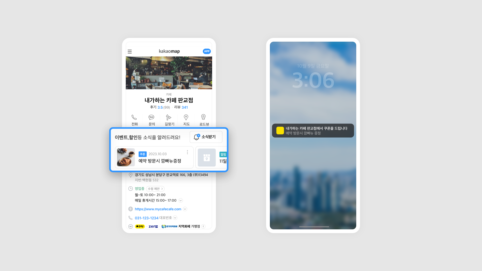
April, who heads the Map Planning Part, explains, "Search methods have diversified from portal sites to various social media and map services. While a map app can't become a portal, it can certainly present location-based content in an integrated search-like manner. For instance, entering a desired menu item could bring up a well-organized display of image search results, dining reviews, and user created groups of recommended restaurants for that dish. It's also becoming common for small business owners to input and manage their business information themselves, especially with the integration of KakaoTalk channels enabling direct customer communication. From search to content viewing, connecting, and navigating, location-based communication mediated by maps has become a part of our daily lives."

With each layer of information added to the 'board' of the map, developers face new challenges. Kris, the head of the Map Development Part, comments, "In the past, we focused on providing geographic information, but the complexity of development and maintenance has increased as map services now facilitate a wide range of content consumption. Amidst the general improvement of various map services, the reason to choose KakaoMap ultimately lies in its user-friendly access to technically differentiated features like ultra-precise bus tracking."
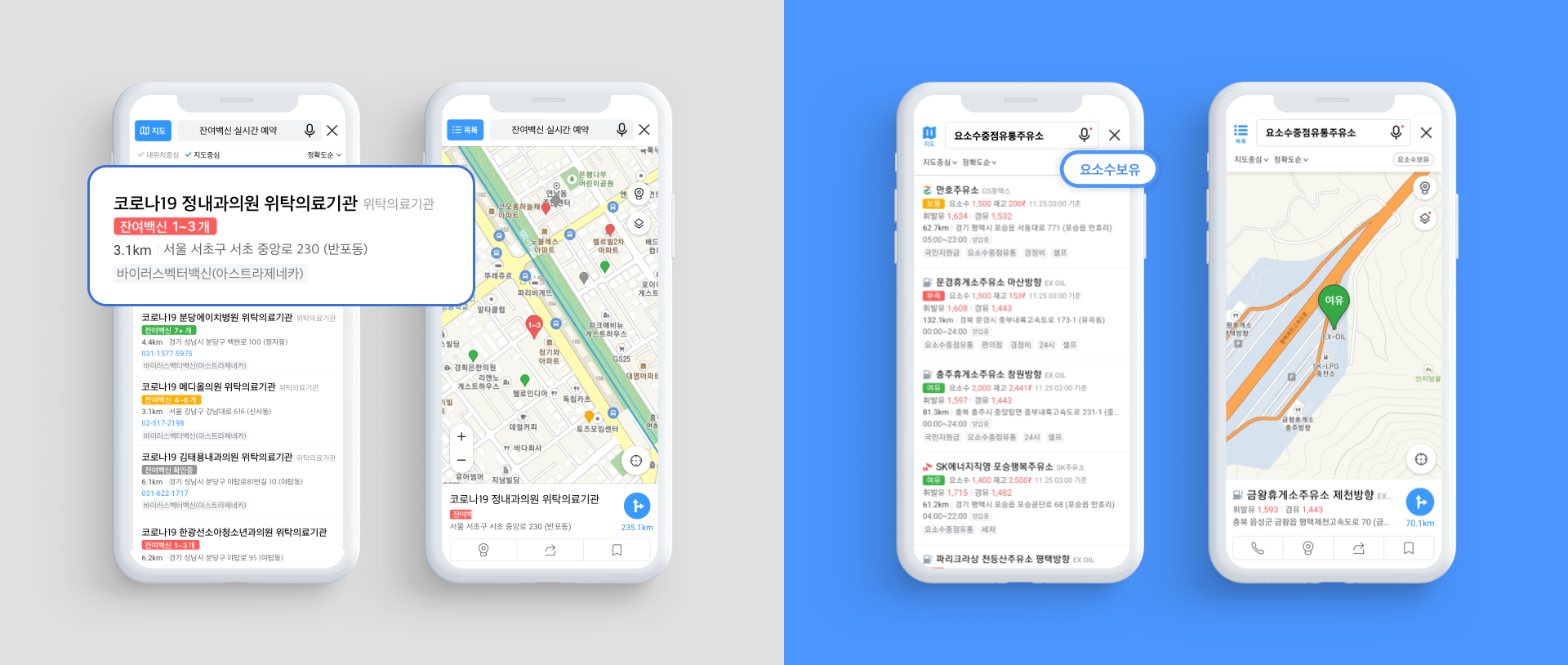
Despite the transition from manual to digital tools in map creation and the layering of information and narratives, the essence of maps as a crystallization of humanity's collective intellectual asset remains unchanged. KakaoMap's proactive response during the COVID19 pandemic, rolling up its sleeves to provide vital information like vaccination sites, the congestion level at screening centers, and emergency disaster relief fund usage locations, exemplifies steps taken as a member of the community. Similarly, during the urea solution crisis, providing information on sales locations was another stride in its commitment to communal support.
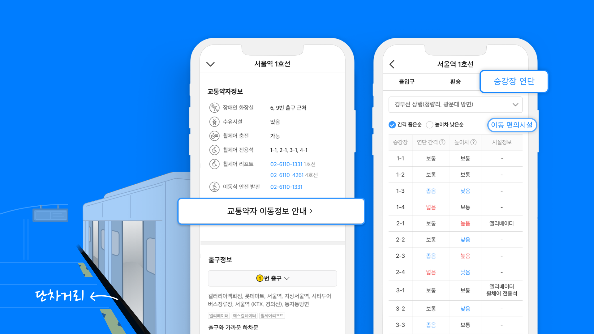
Offering specialized mobility information for those with transportation needs and detailing aspects like the gap and height disparity between subway platforms and trains aligns with this same ethos.
The functionality developed for convenience often contributes to public welfare when used by many. A prime example is the reduced carbon footprint by users of the bicycle navigation feature. In 2022, the bike route-finding function was used over 68.7 million times, and the cumulative distance traveled by users who recorded their journeys post navigation exceeded 13.5 million km. This equates to the amount of carbon dioxide absorption that would require about 427,000 pine trees.
KakaoMap has spent 24 years layering diverse information and cultivating social value. But are there hidden gems in the service yet to be fully recognized? In wrapping up our conversation, we turned to April, involved in service planning, to highlight three standout features of KakaoMap.
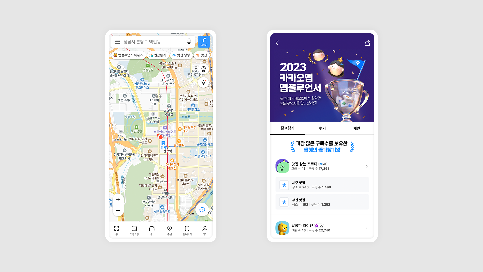
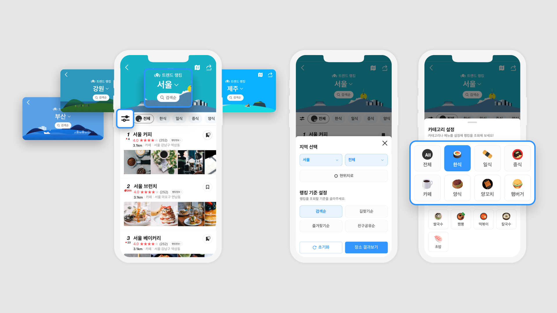
“Firstly, I’d recommend the ‘Trend Ranking,’ which compiles and displays places that have seen a surge in searches or are frequently chosen as navigation destinations. It’s a great guide when you’re wondering what to eat in a new place or curious about popular travel spots. Next, I can’t omit KakaoMap’s signature feature, the public transport boarding and alighting alarm. When it’s difficult to see the stop signs or hear the announcements, this function alerts you via vibration or voice about where to get off, making your commute worry free even when engrossed in webtoons or videos. Finally, I recommend the ‘Reservation’ and ‘Order (Delivery)’ functions. They seamlessly connect the experience from searching for a place to actually utilizing it.”
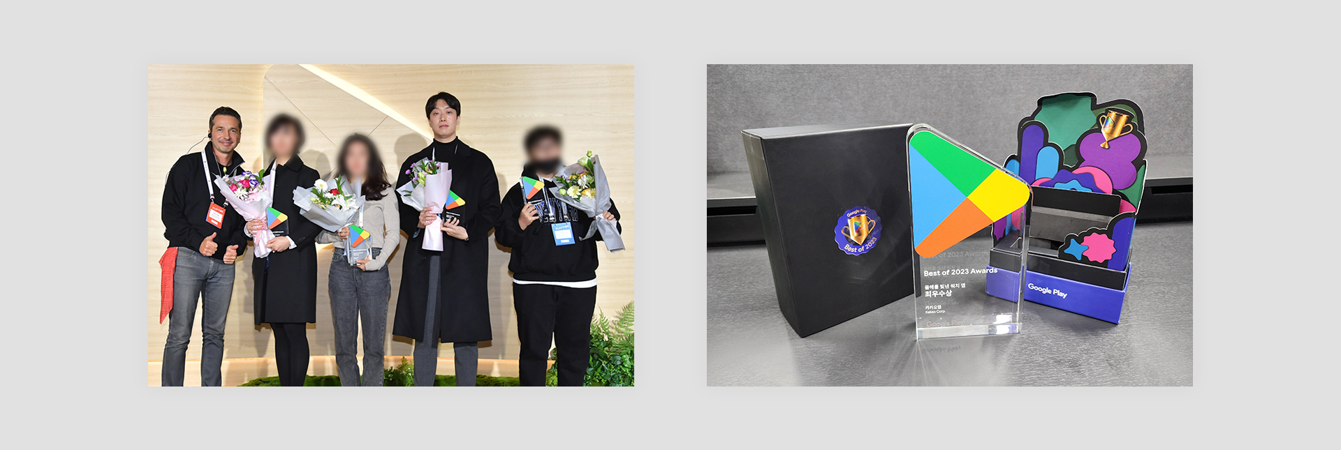
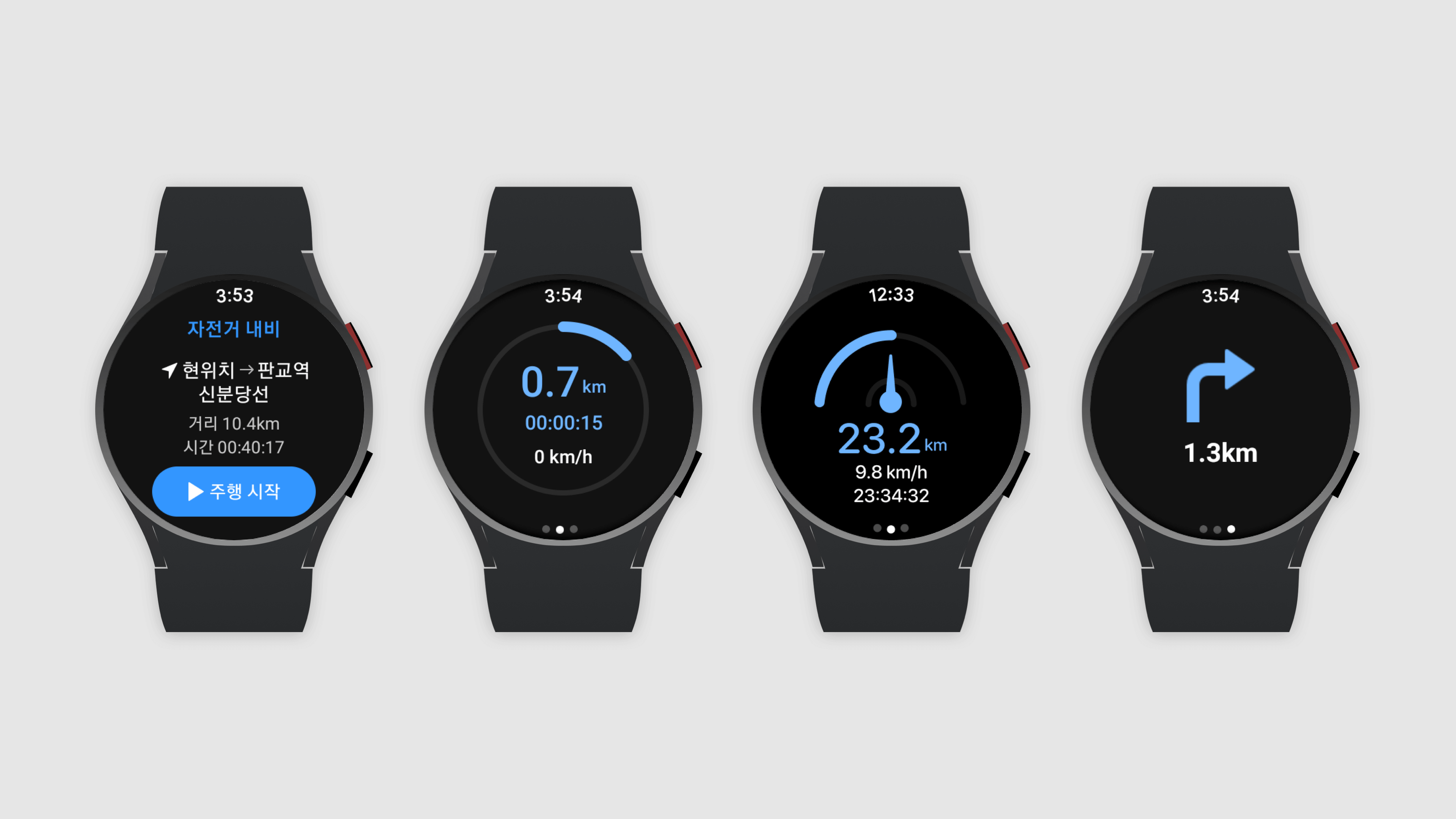
[Note] During the course of writing this story, KakaoMap was honored in the 'Google Play Best of 2023' awards as the 'Best Watch App of the Year. 'The KakaoMap Krews extend heartfelt thanks to all its users and readers!
- Tech Service The development of an image classification model
 #ComputerVision#DeepLearning#ImageClassification#kakaomap
